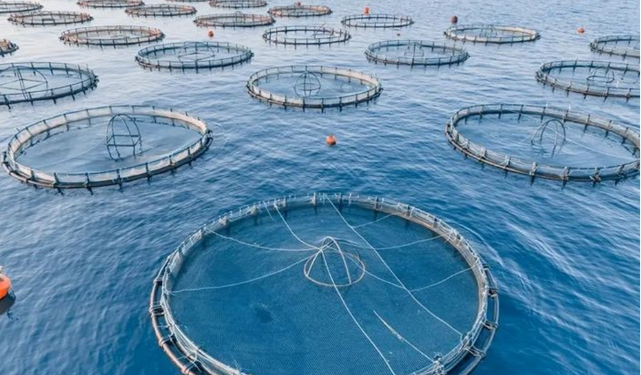
National Authority for Remote Sensing Targets Investment Map for Aquaculture in the Red Sea – The National Authority for Remote Sensing and Space Sciences (NARSS) has unveiled plans to develop an investment map identifying optimal sites for aquaculture using floating cages in the open waters of the Red Sea.
Dr. Islam Abu El-Magd, Chairman of NARSS, emphasized that this project represents a practical model for aligning the authority’s strategic and research plans with national development strategies. The initiative aims to achieve sustainable development goals, maximize the return on scientific research, and create investment opportunities that boost production and provide employment for young people.
According to Abu El-Magd, the project’s outcomes are distinguished by their focus on balancing economic development with environmental preservation. The identified sites are ideal from both ecological and economic perspectives, meeting aquaculture requirements without negatively impacting sensitive ecosystems such as coral reefs and protected areas.
The project identified approximately 255 square kilometers of suitable areas for fish farming using floating cages. It also developed spatial distribution models for optimal fish farming locations, taking into account environmental and economic factors.
Dr. Samah El-Kafrawy, Head of the Marine Sciences Department at NARSS, highlighted the integration of advanced scientific research and technology in the project. He explained that the team utilized modern remote sensing techniques, providing accurate and comprehensive data to analyze environmental and climatic conditions in the Red Sea. These analyses included surface sea temperature, chlorophyll concentrations, wind speed and direction, as well as detailed mapping of marine habitats and seabed environments.
El-Kafrawy noted that these advanced tools enabled the research team to identify optimal locations for sustainable fish farming with minimal environmental impact.
Assistant Researcher Ali Abdel-Hamid emphasized that this project marks a transformative step for aquaculture in Egypt. It provides scientific tools and precise data to decision-makers and investors, paving the way for local and international investments in the aquaculture sector.
“The project focuses on enhancing investments, creating job opportunities, and improving living standards in coastal communities,”
Abdel-Hamid stated. He added that the resulting maps enhance Egypt’s competitiveness in global markets by promoting the sustainable use of natural resources.
This initiative underscores Egypt’s commitment to leveraging cutting-edge technology and scientific research to support sustainable development, protect marine ecosystems, and drive economic growth in coastal regions.
National Authority for Remote Sensing Targets Investment Map for Aquaculture in the Red Sea