

Mapping the future of aquaculture: how a Ghanaian innovator is bringing fish farms onto the digital map – In Ghana, where aquaculture plays an increasingly important role in food security, livelihoods and the Blue Economy, access to reliable information about fish farms remains a significant challenge. Knowing where farms are located, whether they are active, what species they produce and which farming systems they use is essential for effective sector management.
Yet this information is not always easily accessible or integrated into a single geographical platform.
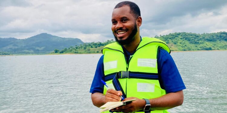
This is the challenge that inspired Samuel Sackey-Addo, a Ghanaian innovator who has combined his knowledge of the aquaculture sector with his expertise in geospatial technologies and Geographic Information Systems (GIS) to develop the Volta Aquaculture Farms Mapping Application.
We had the opportunity to meet Samuel and discover how a practical understanding of the sector’s needs can become the starting point for a digital innovation with far-reaching potential.
Making aquaculture visible: one farm at a time
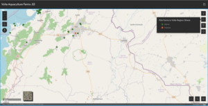
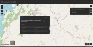
Developed using ArcGIS Online, the Volta Aquaculture Farms Mapping Application is an interactive web-based platform that maps fish farms across Ghana’s Volta Region.
The application allows users to explore farm locations, distinguish between active and inactive operations, access basic information about the species farmed and production systems, filter farms by district and obtain directions to individual sites.
At first glance, it may appear to be a straightforward mapping tool. In reality, its value goes much further.
By transforming fragmented information into an accessible geographical overview, the application makes the aquaculture sector more visible, understandable and actionable.
For extension officers, this means being able to identify farms requiring attention, organise field visits more efficiently and provide technical assistance tailored to farmers’ needs.
For public authorities and sector managers, it offers a spatial perspective to support planning, resource allocation and evidence-based decision-making.
For inspection and enforcement officers, it provides a practical way to locate farms and facilitate compliance monitoring.
Ultimately, it can help bridge the distance between institutions and farmers, making technical support and sector management more targeted and effective.
When sector knowledge meets GIS innovation
What makes Samuel’s initiative particularly interesting is the combination of two complementary areas of expertise.
His understanding of aquaculture helped him recognise a concrete need: the lack of an immediate, geographically organised picture of farming activities.
His GIS and geospatial skills provided the means to respond.
Rather than developing technology for its own sake, Samuel started from a practical challenge and designed a tool around the needs of those working in the sector.
This approach reflects an important principle of Blue Economy innovation: the most valuable digital solutions are often those that emerge directly from an understanding of local realities.
A geographical map is not simply a representation of where activities take place. It is a new way of reading a sector, recognising patterns, identifying gaps and connecting people, infrastructure and services.
And this is precisely where the potential of GIS becomes especially compelling.
Beyond the Map: the power of multiple layers
One of the most promising aspects of the Volta Aquaculture Farms Mapping Application is its potential to evolve.
GIS technology allows different layers of information to be integrated within the same geographical environment. As new datasets become available, the map can progressively become a richer and more powerful decision-support tool.
In the future, additional layers could include production characteristics, environmental conditions, water resources, infrastructure, accessibility, farm support needs and other indicators relevant to sustainable aquaculture development.
The result could be much more than an inventory of farms.
It could become a dynamic platform for understanding the relationships between aquaculture production, local territories, environmental resources and management priorities.
This is the real strength of a GIS-based approach: the map is only the beginning. Each additional layer can reveal new information, new connections and new opportunities for action.
From the Volta Region to a national vision
The application currently focuses on Ghana’s Volta Region, but its underlying approach could be replicated across the country.
A nationwide expansion could contribute to the development of a comprehensive spatial inventory of aquaculture farms, making it easier for institutions to reach farmers, coordinate extension services, monitor sector development and plan interventions.
It could also complement existing aquaculture information systems by adding a geographical dimension to data collection, analysis and operational decision-making.
As a pioneering initiative in the Ghanaian aquaculture context, the application demonstrates how locally developed digital tools can respond to challenges that are shared by many countries.
Indeed, the need for accurate farm mapping, accessible spatial information and more efficient field operations is not unique to Ghana.
Across Africa and in other emerging aquaculture economies, similar approaches could help strengthen governance, improve technical assistance and support more sustainable sector development.
A local innovation with potential beyond borders
Our meeting with Samuel Sackey-Addo highlighted something that goes beyond the technology itself.
Innovation does not always require complex infrastructure or large-scale investment from the outset. Sometimes, it begins with the ability to recognise what is missing, connect different areas of knowledge and create a practical solution.
The Volta Aquaculture Farms Mapping Application is an example of how digital skills, sector experience and local initiative can come together to address real operational challenges.
Its potential lies not only in mapping existing farms but also in building a foundation for future knowledge, stronger connections with farmers and more informed management of aquaculture resources.
Mapping the future of aquaculture: how a Ghanaian innovator is bringing fish farms onto the digital map